
Nibung Terjun
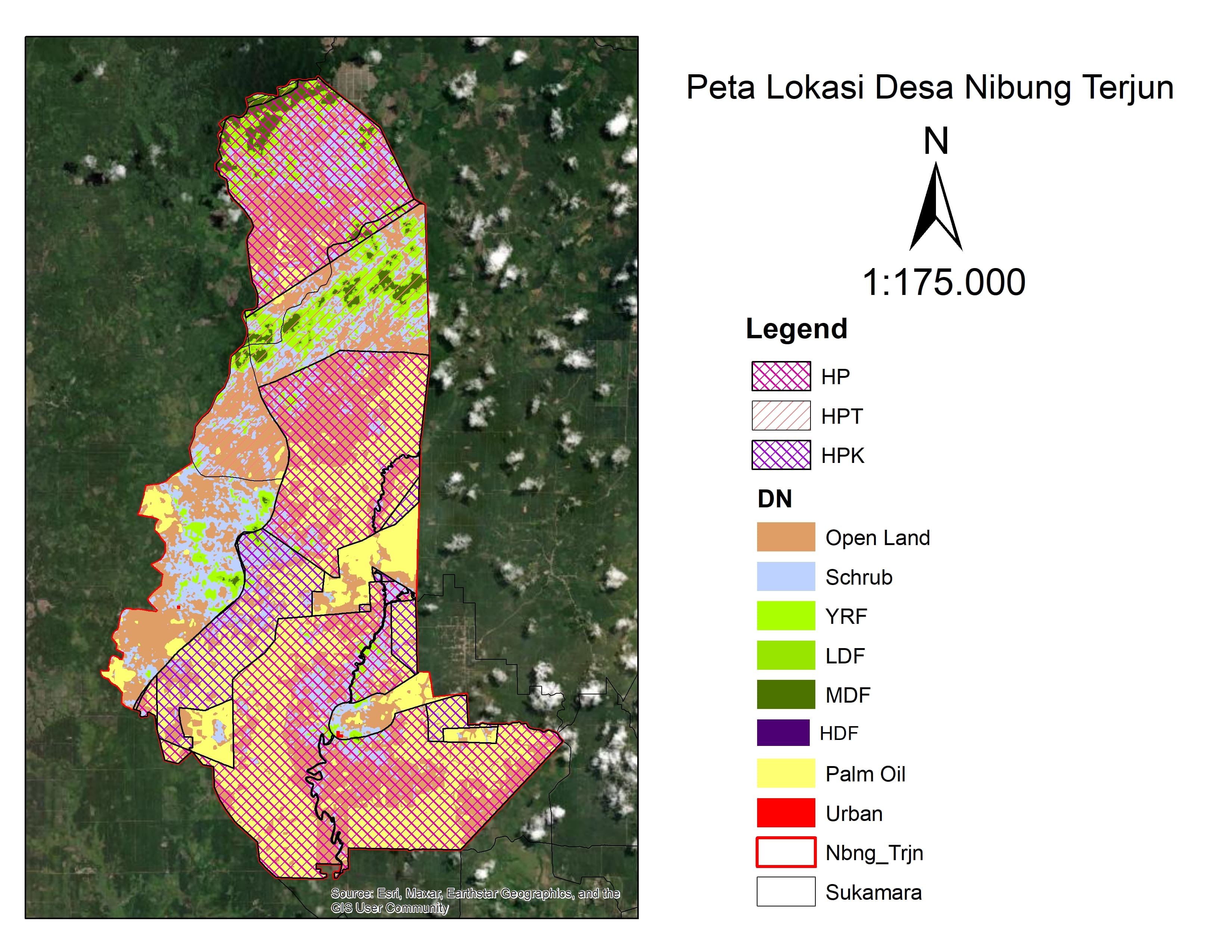
Nibung Terjun Village is located in Permata Kecubung Subdistrict, Sukamara Regency, Central Kalimantan Province, with a total area of approximately 113 km² (11,300 hectares). Geographically, the village borders Pakit Selaba Village (Manis Mata Subdistrict) to the north, Sembikuan Village (Permata Kecubung Subdistrict) to the east, Pempaning Village (Balai Riam Subdistrict) to the south, and Silat Village to the west. Nibung Terjun Village has a population of 1,180 people spread across 375 households.
0
Total Farmers
0
Farmer Groups
47
Protected Forest (Ha)
0
Village Documents
Location Map
Lat: -2.2047360 | Lng: 111.0872260
Village Narrative & Story
Geographical Condition & Profile
Nibung Terjun Village is located in Permata Kecubung Subdistrict, Sukamara Regency, Central Kalimantan Province, with a total area of approximately 113 km² (11,300 hectares). Geographically, the village borders Pakit Selaba Village (Manis Mata Subdistrict) to the north, Sembikuan Village (Permata Kecubung Subdistrict) to the east, Pempaning Village (Balai Riam Subdistrict) to the south, and Silat Village to the west. Nibung Terjun Village has a population of 1,180 people spread across 375 households.
Indigenous People & Local Wisdom
-
Commodity Distribution
No commodity data.
Farmer Groups
No farmer group data yet.
Land Use & Forest Data
Latest data year: 2025
| Year | Forest/Land Name | Indicative (Ha) | Definitive (Ha) | Type | Status | HCS-HCV |
|---|---|---|---|---|---|---|
| 2025 | - | 46.65 | 46.65 | - | Area Penggunaan Lain (APL) | - |
Visual Gallery
Reference Documents
No documents yet.