
Kartamulia
Kartamulia Village is one of the villages located in Sukamara Subdistrict, Sukamara Regency, Central Kalimantan Province. The village covers an area of approximately 148 km² (14,800 hectares) and accounts for about 14.40% of the total area of Sukamara Subdistrict. Geographically, Kartamulia Village is bordered by the Jelai River to the north, Mendawai Subdistrict to the east, Padang Subdistrict to the south, and Nibung Terjun Village to the west. The distance from Kartamulia Village to the subdistrict capital is approximately 9.30 km.
Administratively, Kartamulia Village consists of 3 Neighborhood Units (RW) and 8 Neighborhood Groups (RT). According to population data, the population of Kartamulia Village totals 6,364 people, comprising 3,455 males and 2,909 females. This village accounts for approximately 19.78% of the total population in Sukamara Subdistrict. The number of households is recorded at 2,256, with 2,009 headed by men and 247 by women.
0
Total Farmers
0
Farmer Groups
127
Protected Forest (Ha)
0
Village Documents
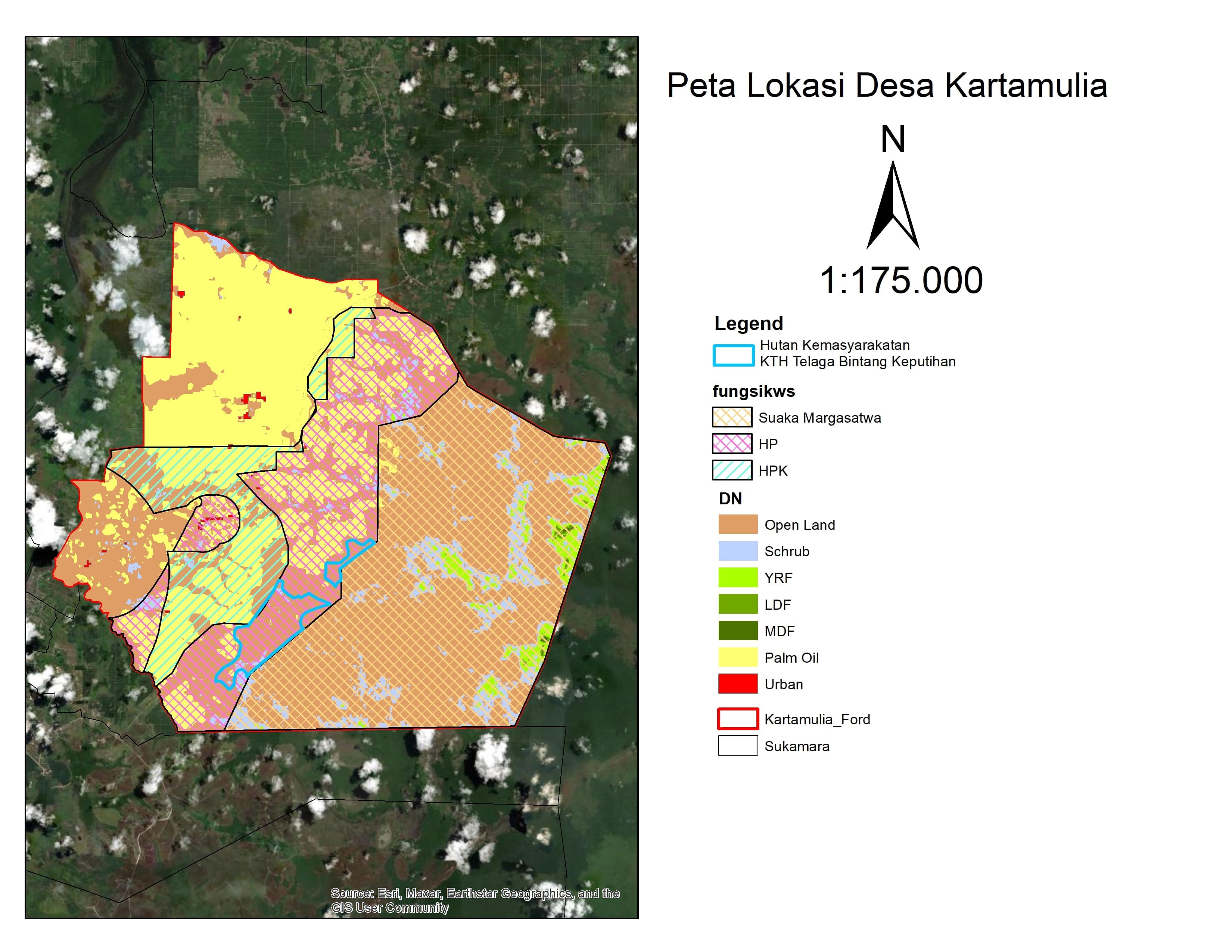
Location Map
Lat: -2.6639050 | Lng: 111.2605550
Village Narrative & Story
Geographical Condition & Profile
Kartamulia Village is one of the villages located in Sukamara Subdistrict, Sukamara Regency, Central Kalimantan Province. The village covers an area of approximately 148 km² (14,800 hectares) and accounts for about 14.40% of the total area of Sukamara Subdistrict. Geographically, Kartamulia Village is bordered by the Jelai River to the north, Mendawai Subdistrict to the east, Padang Subdistrict to the south, and Nibung Terjun Village to the west. The distance from Kartamulia Village to the subdistrict capital is approximately 9.30 km.
Administratively, Kartamulia Village consists of 3 Neighborhood Units (RW) and 8 Neighborhood Groups (RT). According to population data, the population of Kartamulia Village totals 6,364 people, comprising 3,455 males and 2,909 females. This village accounts for approximately 19.78% of the total population in Sukamara Subdistrict. The number of households is recorded at 2,256, with 2,009 headed by men and 247 by women.
Indigenous People & Local Wisdom
On Proses
Commodity Distribution
No commodity data.
Farmer Groups
No farmer group data yet.
Land Use & Forest Data
Latest data year: 2024
| Year | Forest/Land Name | Indicative (Ha) | Definitive (Ha) | Type | Status | HCS-HCV |
|---|---|---|---|---|---|---|
| 2024 | - | 126.53 | 126.53 | - | Area Penggunaan Lain (APL) | - |
Visual Gallery
Reference Documents
No documents yet.