
Semantun
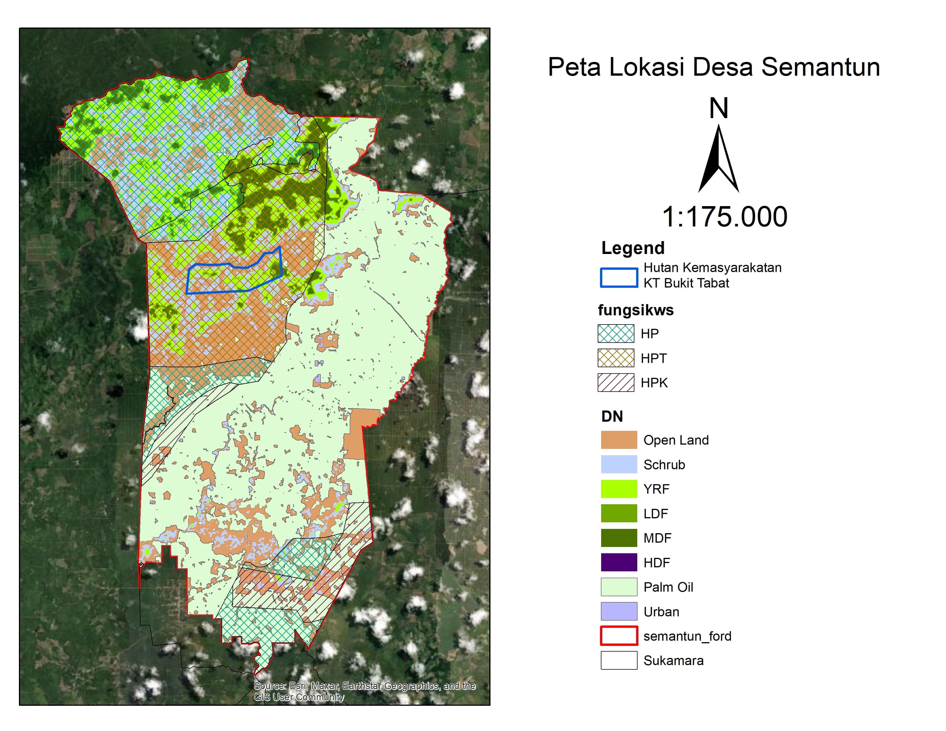
Semantun Village is located in Permata Kecubung Subdistrict, Sukamara Regency, Central Kalimantan Province. It is the largest village in Permata Kecubung Subdistrict, covering an area of approximately 165 km² (16,500 hectares). Geographically, Semantun Village borders Karang Dangin Village (Jelai Hulu Subdistrict) to the north, Asam Jelai Village (Jelai Hulu Subdistrict) to the east, Kesuma Jaya Village (Bekri Subdistrict) to the south, and Tanggerang Village (Jelai Hulu Subdistrict) to the west. The population of Semantun Village is 1,110 people, spread across 371 households.
0
Total Farmers
0
Farmer Groups
95
Protected Forest (Ha)
0
Village Documents
Location Map
Lat: -2.1328440 | Lng: 111.1697980
Village Narrative & Story
Geographical Condition & Profile
Semantun Village is located in Permata Kecubung Subdistrict, Sukamara Regency, Central Kalimantan Province. It is the largest village in Permata Kecubung Subdistrict, covering an area of approximately 165 km² (16,500 hectares). Geographically, Semantun Village borders Karang Dangin Village (Jelai Hulu Subdistrict) to the north, Asam Jelai Village (Jelai Hulu Subdistrict) to the east, Kesuma Jaya Village (Bekri Subdistrict) to the south, and Tanggerang Village (Jelai Hulu Subdistrict) to the west. The population of Semantun Village is 1,110 people, spread across 371 households.
Indigenous People & Local Wisdom
On Proses
Commodity Distribution
No commodity data.
Farmer Groups
No farmer group data yet.
Land Use & Forest Data
Latest data year: 2024
| Year | Forest/Land Name | Indicative (Ha) | Definitive (Ha) | Type | Status | HCS-HCV |
|---|---|---|---|---|---|---|
| 2024 | - | 94.50 | 94.50 | - | Area Penggunaan Lain (APL) | - |
Visual Gallery
Reference Documents
No documents yet.