
Tapang Perodah
Tapang Perodah Village is the farthest village from the sub-district capital of Sekadau Hulu, located about 60 km away. It covers an area of 62.58 km² (10.93% of the sub-district), consisting of 5 community units (RW) and 12 neighborhood units (RT). The village is led by Head of Village Alba Donatus and has a population of 1,985 people (994 males and 991 females) with 509 households.
0
Total Farmers
0
Farmer Groups
-
Protected Forest (Ha)
0
Village Documents
Location Map
Lat: -0.1783700 | Lng: 111.0406860
Village Narrative & Story
Geographical Condition & Profile
Tapang Perodah Village is the farthest village from the sub-district capital, with a distance of approximately 60 kilometers. The total area of the village is 62.58 km², or about 10.93 percent of the sub-district area. It consists of 5 community units (RW) and 12 neighborhood units (RT).
The Head of Tapang Perodah Village is Mr. Alba Donatus. The population consists of 994 males and 991 females, with a total of 1,985 people. The population percentage is 7.75 percent, with a population density of 45.02 people per km² and a sex ratio of 100.84. The total number of households is 509.
Tapang Perodah Village is one of the food production centers in Sekadau Hulu Sub-district during the period of 2021–2024. In addition, the village also has tourism potential in the form of Pelaboh Bindang Waterfall, located approximately 20 km from the district capital.
Administratively, the village consists of four hamlets: Tapang Perodah, Danau Raya, Suak Bala, and Tembawang Nangka. The village officials include 2 high school graduates, 1 diploma holder, and 3 bachelor’s degree holders.
Indigenous People & Local Wisdom
On Proses
Commodity Distribution
No commodity data.
Farmer Groups
No farmer group data yet.
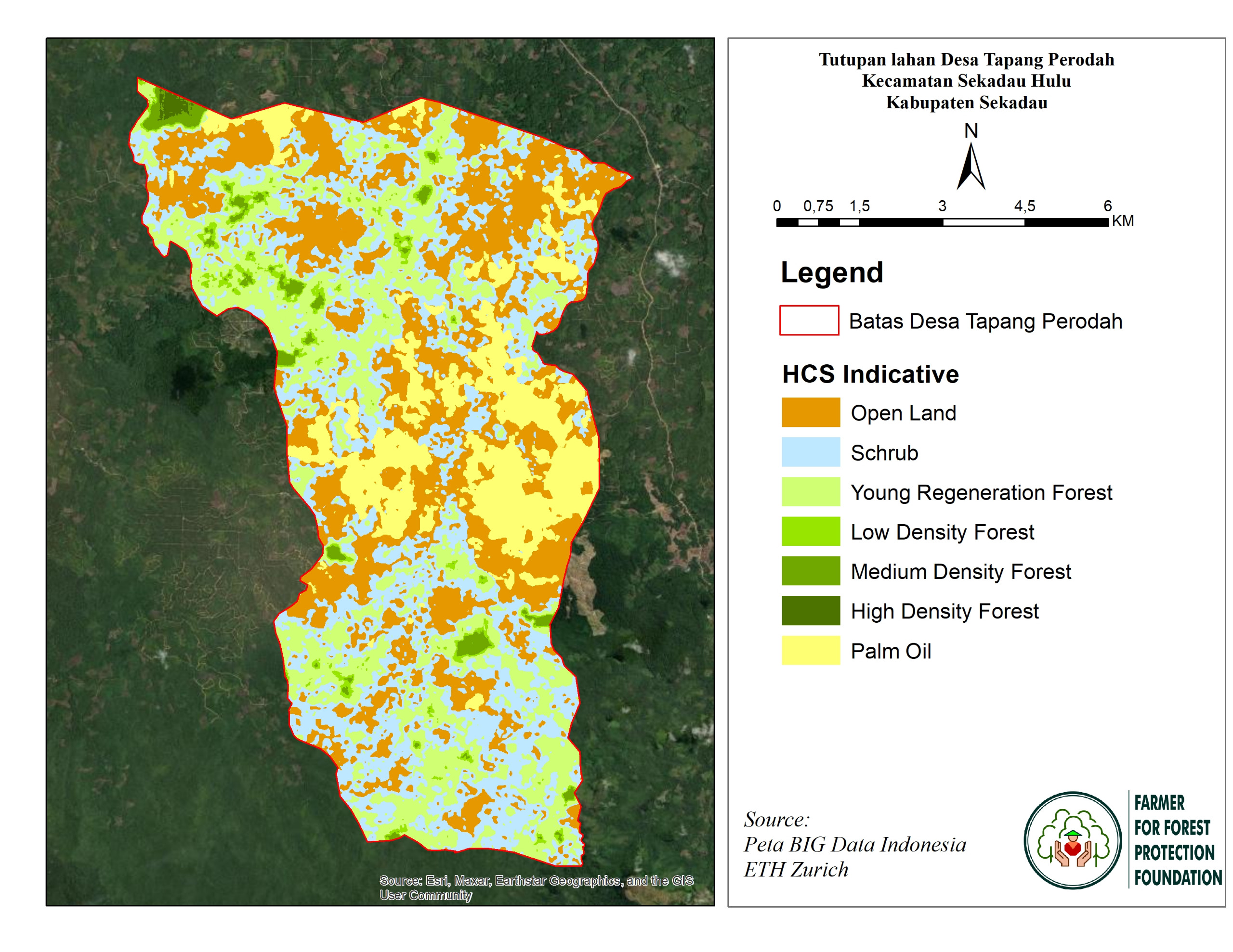
Land Use & Forest Data
No forest data yet.
Visual Gallery
Reference Documents
No documents yet.