
Setawar
Setawar Village is located in Sekadau Hulu Subdistrict, Sekadau Regency, West Kalimantan Province, covering an area of 6,552 hectares. To the north, it borders Gonis Tekam and Engkersik Villages; to the east, Nanga Pemubuh and Tapang Perodah Villages; to the south, Boti and Sungai Sambang Villages; and to the west, Nanga Pemubuh and Tapang Perodah Villages.
392
Total Farmers
1
Farmer Groups
302
Protected Forest (Ha)
1
Village Documents
Location Map
Lat: -0.0925990 | Lng: 111.0027890
Village Narrative & Story
Geographical Condition & Profile
Setawar Village is located in Sekadau Hulu Subdistrict, Sekadau Regency, West Kalimantan Province, covering an area of 6,552 hectares. To the north, it borders Gonis Tekam and Engkersik Villages; to the east, Nanga Pemubuh and Tapang Perodah Villages; to the south, Boti and Sungai Sambang Villages; and to the west, Nanga Pemubuh and Tapang Perodah Villages.
The village has a population of 1,097 people living in three hamlets: Sidap (277 people), Setawar (253 people), and Beransit (34 people). The majority of residents (392 people) work as farmers or smallholders.
The name “Setawar” originates from the Benawas language, meaning “freshwater river.” The name has been used since 1942; previously, the area was known as Piansak. Officially, Setawar Village was established in 1987 following the issuance of West Kalimantan Governor Decree No. 053 of 1987 concerning Village Formation and Consolidation.
Indigenous People & Local Wisdom
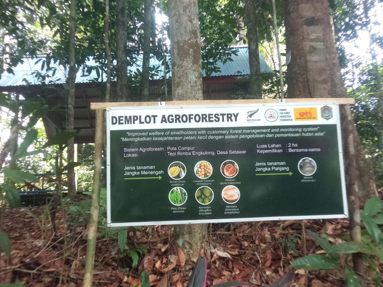
Rimba Engkulong Forest Guard
Commodity Distribution
Farmer Groups
| Group Name | Type | Members |
|---|---|---|
| Setawar Village Forest Guard | Group | 5 |
Land Use & Forest Data
Latest data year: 2023
| Year | Forest/Land Name | Indicative (Ha) | Definitive (Ha) | Type | Status | HCS-HCV |
|---|---|---|---|---|---|---|
| 2023 | - | 302.12 | 302.12 | - | Other Use Area/APL | - |
Visual Gallery

Reference Documents
| Document Title | Description | Action |
|---|---|---|
| VIllage Regulations of Setawar | The Village Regulations of Setawar is the result of collaboration between 4F and Setawar Village in the protection and management of forest areas in Setawar Village. This village regulation is one of the outcomes of the overall programme implemented by 4F in Setawar Village with funding from the New Zealand Government's Head of Embassy Fund. | Download |