
Hopes for Preserving the Remaining Jointly Managed Forests
Farmers for Forest Protection Foundation (4F)
In the meeting room of Nibung Terjun Village, nineteen representatives of the community and village government took part in Deliberation 2 (the identification of important community areas) on 8 April 2026. This deliberation marked the fourth stage in implementing the HCS-HCV (High Carbon Stock–High Conservation Value) approach, in which the social experts' findings were presented to participants, and from that data the community collectively identified the important areas they wished to protect.
In this deliberation, the community representatives present identified two forest areas they wished to protect together: Bukit Panjang Cerincingan Angin Forest, commonly known as Cerincingan Angin, and Melatup River Forest. Alongside these two forests, they also included a sacred stone site as an important area to be safeguarded jointly.
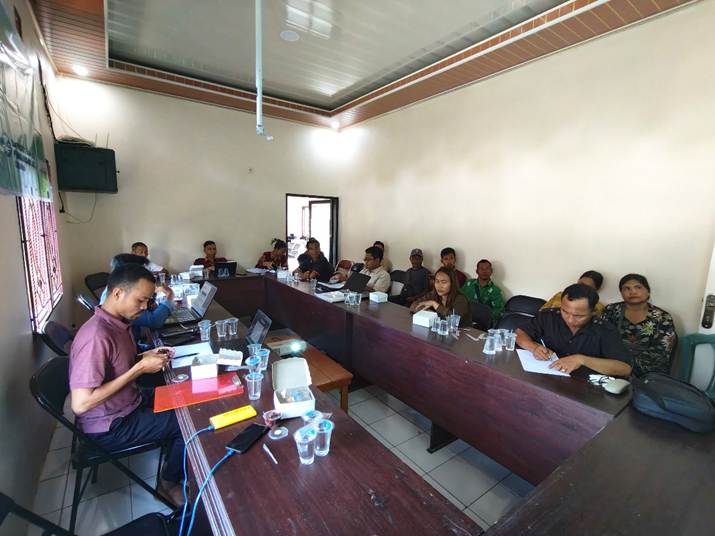
Figure 1. Participants in Deliberation 2 at the meeting hall of Nibung Terjun Village office, 9 April 2026.
Beyond wanting to protect these areas jointly, the community intended to put both forests forward as customary forest (hutan adat) for Nibung Terjun. As such, they saw 4F's work in the village as clearing the way towards that goal. Mr Gani, the customary chief of Dayak Ruku Mapam, Nibung Terjun Village, expressed his enthusiasm for 4F's activities there. During Deliberation 2 in particular, he voiced his hope that Cerincingan Angin Forest would soon be designated as customary forest, complete with its own forest ranger team.
“Bukit Panjang Cerincingan Angin – let us protect it together. If not us, then who? If not now, then when? As it happens, the gentlemen from the 4F team are willing to help us, willing to lend a hand. Let us stand shoulder to shoulder, supporting one another. If we're ever unsure of something, let's ask them, since they're here with us today. Whatever we lack, whatever difficulties we face, please ask – don't think about money, don't go there first. Having considered it, my proposal is that the forest ranger team be set up as soon as possible, so we can protect our forests,” he said.
A Forest Still Pristine and Rich in Life
“There are claw marks here,” said one member of 4F's spatial team, pointing to something on a tree trunk.
“Judging by the size, these are clouded leopard claw marks,” said a local facilitator after considering it for a moment. “If it were a bear, the claw marks would be longer,” he added.
“These claw marks are quite fresh. It looks like the leopard may have been on this tree while we were having lunch,” another member of 4F's spatial team chimed in.
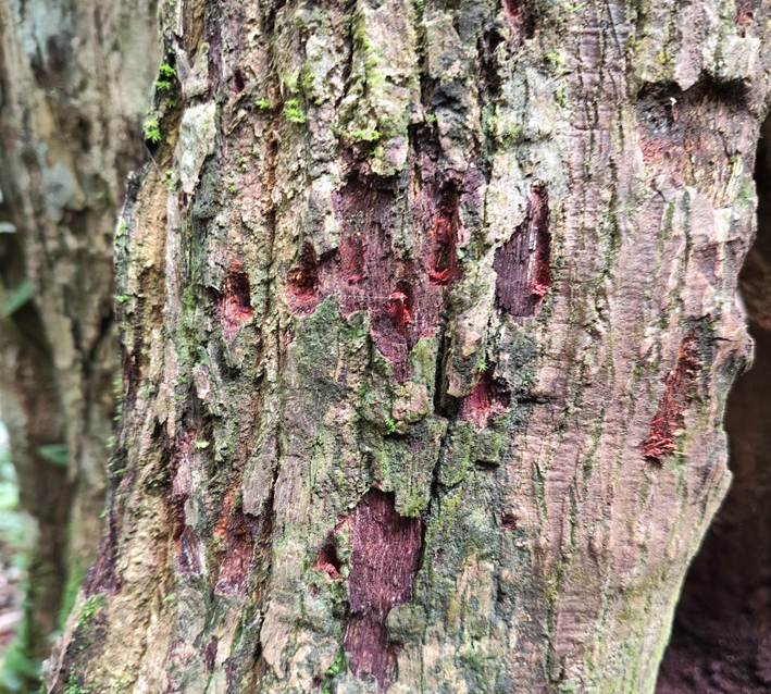
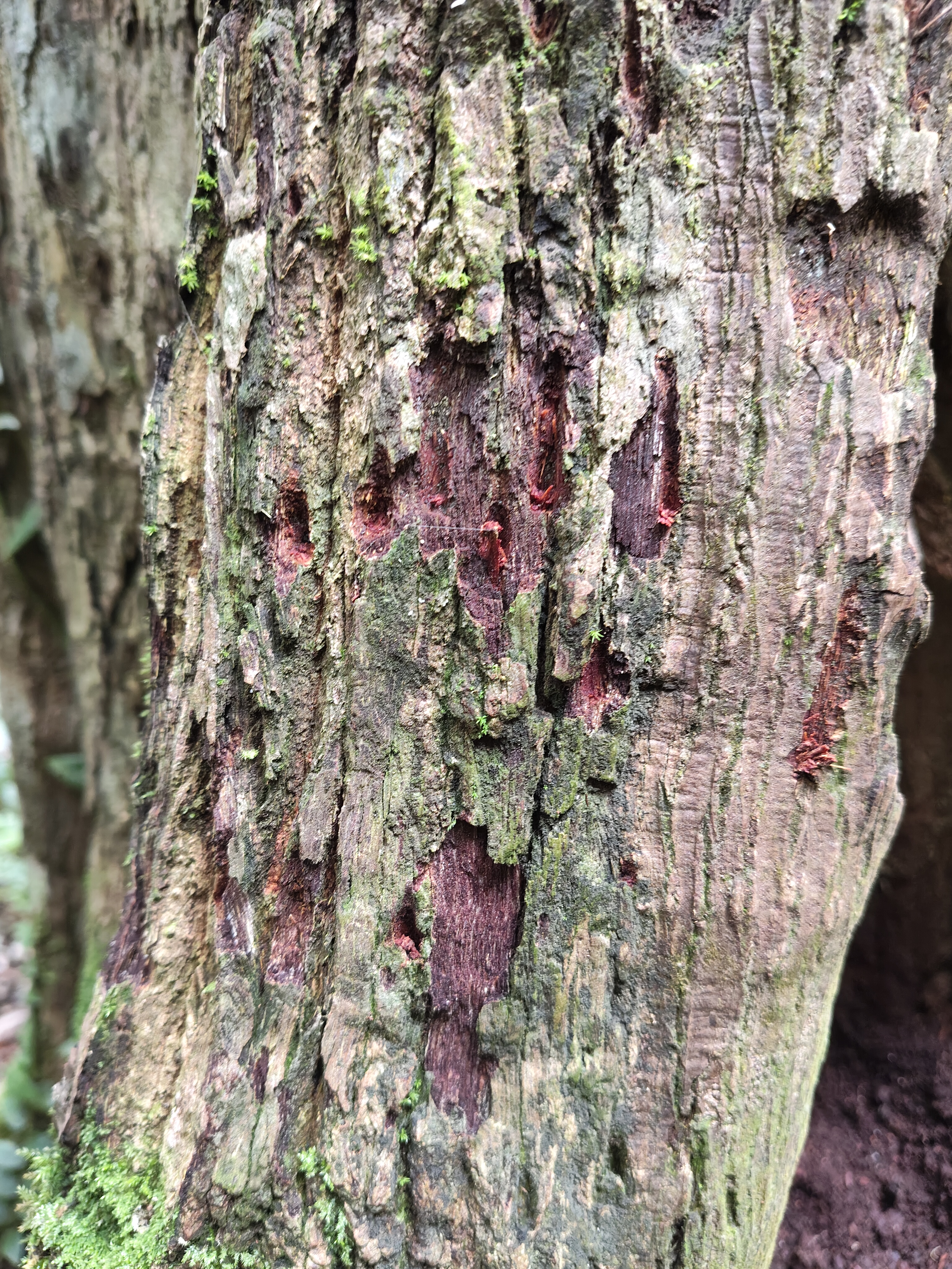
Figure 2. Clouded leopard claw marks on a Janguk tree (Xanthophyllum sp.).
The clouded leopard's claw marks were found on the trunk of a Janguk tree (Xanthophyllum sp.) growing around ten metres from a stream, as the field verification team resumed its work after the lunch break. The marks were still relatively fresh, suggesting the clouded leopard had been in the area roughly an hour earlier. Besides the marks on the Janguk tree, further evidence of the leopard's presence was visible in claw marks on the trunk of a neighbouring Palis tree (Agathis borneensis), as well as tracks and diggings in the ground around both trees.
This evidence of the clouded leopard was found by the verification team in Cerincingan Angin Forest – the first forest surveyed in Nibung Terjun Village by the field verification team, which comprised three members of 4F's spatial team, five staff from the Sukamara Environment Agency, and five representatives of the local community. The terrain here is hilly, forming long ridgelines, and borders – separated by a small stream – land planted with oil palm belonging to a member of the Nibung Terjun community.
The verification team set off for Cerincingan Angin Forest on 10 April 2026 at 9:00am local time. Reaching the forest meant a 19-kilometre journey along inter-village roads, community plantation tracks, and roads belonging to an oil palm company within the land concession (HGU) of PT Kalimantan Sawit Kusuma (KSK). The route was dominated by red, sandy soil and had not been paved at all.
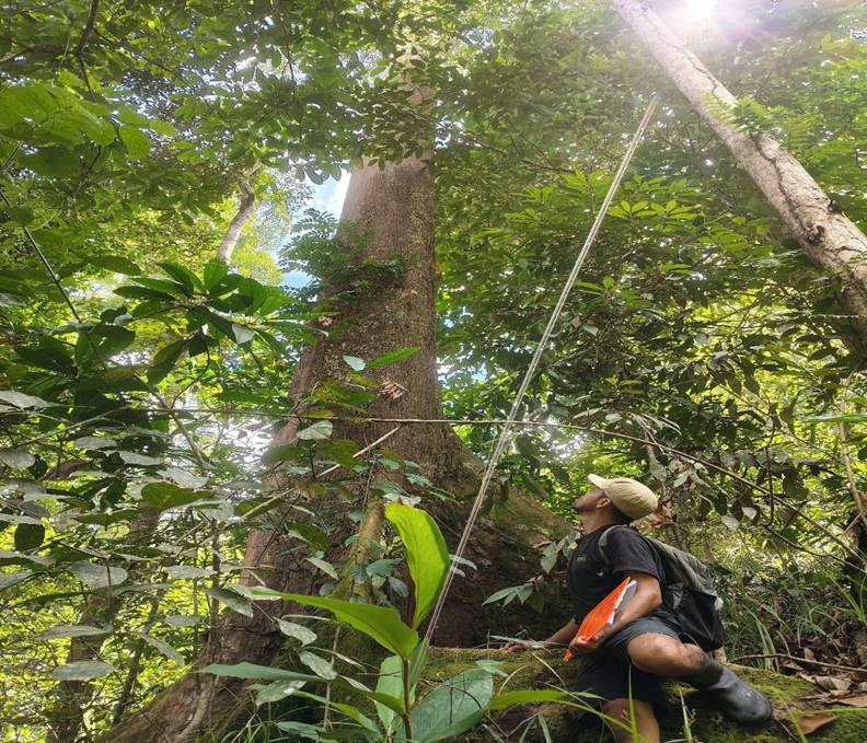
Figure 3. A Majau tree inside Cerincingan Angin Forest.
Cerincingan Angin Forest remains highly pristine and has never suffered any damage. Legally classified as Limited Production Forest, it has not been cleared by companies or communities for farming or plantations, since the area serves as a water catchment and is hilly – meaning that any damage to it could trigger natural disasters such as flooding and landslides.
The pristine condition and biodiversity found in the forest that day were evident not only in the discovery of the bear's claw marks, but also in the presence of native Kalimantan tree species such as Ulin (Eusideroxylon zwageri), Bengkirai (Shorea laevis), Palis (Agathis borneensis), Penaga (Mesua ferrea), Meranti (Shorea spp.), Ubar (Syzygium sp.), Madang (Litsea sp.) and Betulang (Stemonurus celebicus).
Alongside these large trees, the forest is home to plants that the community uses for particular purposes: Temberau (Goniothalamus spp.), used to make fragrances; the Kumpai tree, used in warding-off-misfortune rituals; rattan; Buah Puting Beliung (used to add a sour note to cooking); the fruit of the Mahawak tree (edible, and similar to durian); and Pasak Bumi root (Eurycoma longifolia). Beyond its flora and fauna, another striking feature discovered within Cerincingan Angin Forest was a multi-tiered waterfall, although the tiers were spaced quite far apart – around 500 to 1,000 metres from one another.
An Unfinished Exploration
The following day, 11 April 2026, the verification team set off for Melatup River Forest, one of the forests jointly designated by the community as an important area to be protected.
Melatup River Forest lies close to the RT 03 settlement. The verification team had high hopes that this forest would prove just as pristine and rich as Cerincingan Angin. Those hopes, however, were dashed by what the team found inside. Rather than pristine and untouched, the team discovered quite the opposite: the undergrowth and shrubs had already been cleared, leaving only widely spaced large trees standing – a sign, or an early step, in preparing the land to be cleared for plantation.
When residents living near the forest were asked about this, they explained that Melatup River Forest was not communal land but was privately owned by certain individuals. This information led the verification team to halt its work for the day and jointly decide to remove Melatup River Forest from the list of important community areas to be protected.
Hope for a Sustainable Forest
Following what happened at Melatup River Forest, the verification team decided that the next day's work would return to Cerincingan Angin Forest, this time covering routes and points not yet surveyed. For this follow-up verification, staff from the Sukamara Environment Agency did not take part, and the team split into two groups – one entering the forest on foot, while the other flew a drone from the forest's edge to capture an aerial view of Cerincingan Angin's forest cover.
In this second survey, as in the first, evidence continued to emerge within Cerincingan Angin Forest of animals classified as rare, even though this survey covered slopes and ridgelines rather than the areas along and around the stream surveyed previously. The animal identified this time was the sun bear. Evidence of its presence came from claw marks on the trunks of Betulang (Dillenia sp.) and Penaga (Mesua ferrea) trees, as well as a nest found among a cluster of small trees roughly three metres above the ground.
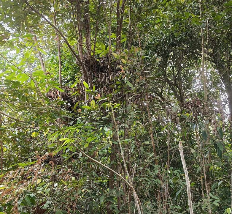
Figure 24. A bear's nest on one of the hill slopes within Cerincingan Angin Forest.
The team's findings – clouded leopard claw marks, bear claw marks, and native plant species – are welcome news for both 4F and the people of Nibung Terjun. Cerincingan Angin is a rich forest that provides a natural habitat for animals that are now rare and difficult to find. This stands as an implicit call for the forest to be protected, or even granted legal protection as swiftly as possible – one route towards which is designating the area as customary forest.
In the hope of securing this future, Mr Gani, the customary chief of Nibung Terjun Village, voiced his aspirations. “I hope the Sukamara district government, as well as the provincial and central governments, will speed up the development of the ecosystem, especially forest guard posts to protect this customary forest. If it comes too late, the forest will end up being damaged by the community. It won't really be the community's fault then – it will be ours. That's why I'm asking the government to build a forest guard post as soon as possible, whether through 4F or through the Sukamara District Environment Agency (DLH),” he said.
Echoing Mr Gani's hopes, Mr Dayus, head of RT 04 in Nibung Terjun Village, voiced a similar wish. “I often go into the area known as the waterfall. I go round it often, I survey it often. As RT head, it's my duty to guard and protect this forest, known as the customary forest. It's already been measured – just over forty hectares, as of yesterday. So nobody, whether from RT 03, RT 04, or anywhere else in Nibung Terjun Village, is allowed to fell trees within this customary forest area. It's forbidden. I have a plantation nearby and often survey around this forest. Thankfully, in all the time I've been keeping watch, I've never once seen anyone from the community damaging or felling trees here,” he told the 4F team.