
Farmers for Forest Protection Foundation (4F)
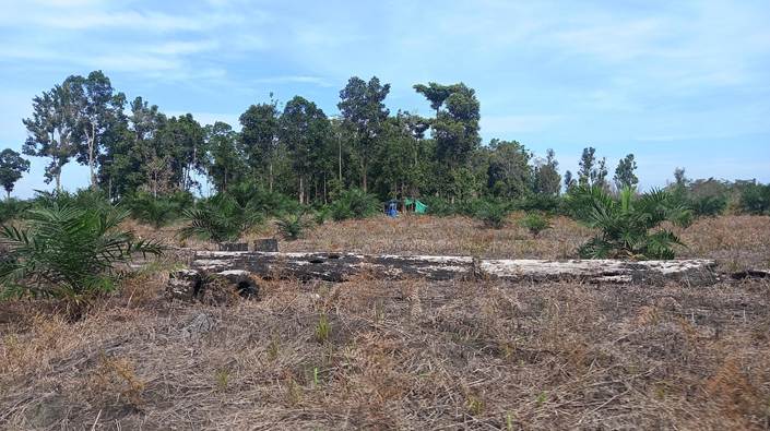
On the morning of 5 April, the weather was fairly bright in Karta Mulia (Sukamara Sub-district, Sukamara Regency). The time was 08.00 WIB. That day marked the first day the 4F team carried out verification of an important community area (forest) in Karta Mulia Village. At the home of Mr Rohmawadi, three members of the 4F team were preparing to set off for the forest area that had been jointly agreed the previous day with community representatives at the second consultation (musyawarah II) to determine the important areas to be protected. Under that agreement, there were three forest areas to be protected: Pangabuyan Forest (±200 ha), Pencaburan Forest (±400 ha), and Pomponing Forest (1.5 ha). The 4F team set off together with two local facilitators, two customary (adat) leaders, and three staff from the Sukamara Regency Environment Agency. The first forests to be identified and verified were Pangabuyan and Pencaburan Forests, as both lie within one large area known as Gambu Dalam.
The journey to the Pangabuyan forest area is about 5 km and takes around 20–30 minutes. The first two kilometres are sealed road, following the main highway connecting Sukamara with Pangkalan Bun, while the remainder is a sandy track commonly used by local people to reach their oil palm smallholdings.
On arrival at the forest edge, around 20 residents were already waiting — all of them men. At first the 4F team assumed they were farmers tending and monitoring their plots. However, on being asked, it turned out they wanted to join the 4F team’s group into the forest. They had even prepared themselves in advance and wanted to witness what the 4F team would be doing inside the forest.
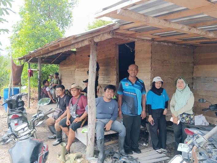
Picture 1. The 4F team, Environment Agency staff and local residents at a hut belonging to a resident with land on the edge of Pangabuyan Forest.
Source: 4F Documentation
Oil Palm Land Within a Wildlife Sanctuary Area
Administratively, Karta Mulia Village has an indicative area of 148 km², or 14,800 hectares. Of this total, 54.1%, or 8,000 hectares, lies within the concession of PT Sungai Rangit, held since 1995 and acquired by PT Sampoerna Agro in 2006. The remaining land outside the oil palm corporation’s occupation — around 6,800 hectares, equivalent to 45.9% — can be assumed to be community-managed territory. However, it turns out that most of this community-managed territory falls within the Lamandau Wildlife Sanctuary protected forest area, whose boundaries have been demarcated to cover 56,584 hectares. The indicative area of protected forest managed by the Lamandau Wildlife Sanctuary within the village amounts to 5,175 hectares, or around 35% of Karta Mulia Village’s total indicative administrative area. This leaves a total indicative area of resources genuinely controlled and managed by the community of just 1,624.5 hectares -- including public facilities and settlements.
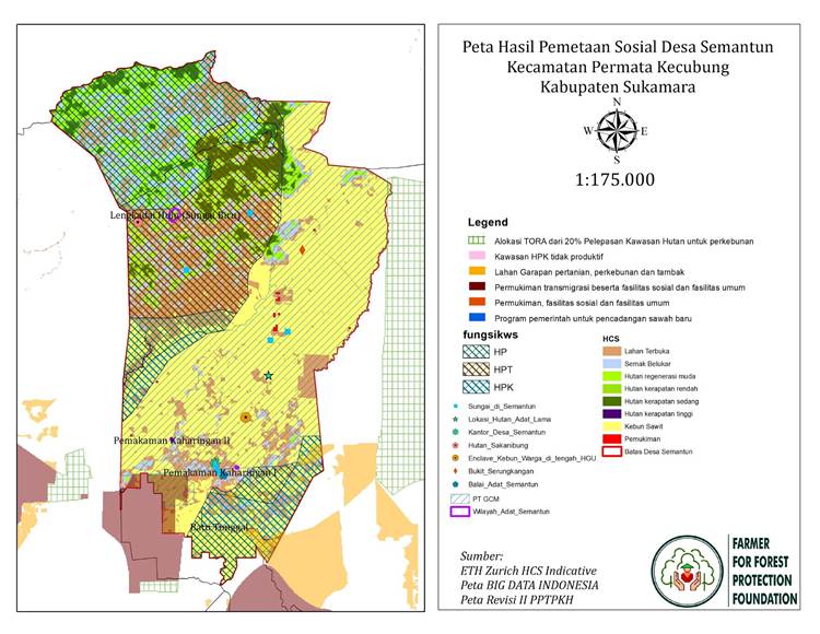
Picture 2. Map of Karta Mulia Village based on the social mapping results.
Source: 4F Documentation
Based on community testimony and direct observation, almost the entire area of Karta Mulia Village is dominated by peat swamp, which makes the village’s land sensitive to hot weather. In the dry season, the swamp areas of Karta Mulia (particularly on the eastern side) are highly vulnerable to forest and land fires caused by El Niño, with dry spells lasting more than six months. The presence of white sandy soil and dried remnants of swamp vegetation makes the land highly flammable. The threat of fire has become a story and recurring event passed down from generation to generation, and is also one of the reasons the Dayak Gambu Dalam community relocated their settlement from Kalokalibar (a large village surrounded by fruit orchards) to the area where the village now stands (in 1987 and 1995).
Residents’ testimony also revealed that the oil palm smallholdings around Pangabuyan and Pencaburan Forests likewise fall within the Lamandau Wildlife Sanctuary area. The oil palm land within this conservation zone is dominated by white quartz sand and peat, making it prone to fire during the dry season. Residents further explained that those who joined the 4F group into the forest did so not only out of enthusiasm, but also as a preventive and protective measure for the continuity of their oil palm land within the Gambu Dalam area. They had assumed the 4F group were officials carrying out observations connected with forest area enforcement, similar to operations carried out by the Forest and Land Fire Task Force (Satgas PKH), because around five years earlier, community oil palm land in the Gambu Dalam area had been deliberately burned by PKH officers. This is why residents remain wary whenever outsiders enter the Gambu Dalam area.
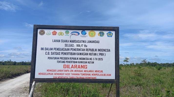
Picture 3. Signboard marking the Lamandau Wildlife Sanctuary in the Gambu Dalam area.
Source: 4F Documentation
The enforcement action carried out by the PKH Task Force occurred because, administratively, the community’s oil palm land in Gambu Dalam falls within the Lamandau Wildlife Sanctuary area. In 1998, on the initiative of the Orangutan Foundation, the Gambu Dalam area changed status to become a wildlife sanctuary, or more precisely, was incorporated into the Lamandau Wildlife Sanctuary area. The designation of this wildlife sanctuary area went through a long process, until in 2010 the Ministry of Forestry issued the Sanctuary Designation Decree for Lamandau, Decree No. SK.17/MENHUT-II/2010, concerning the designation of the Lamandau Wildlife Sanctuary conservation forest area in Kotawaringin Lama Sub-district, Arut Selatan Sub-district (Pangkalan Bun), Sukamara Sub-district and Jelai Sub-district, in West Kotawaringin Regency and Sukamara Regency, Central Kalimantan, covering an area of 56,584 hectares. This designation was reinforced by a Memorandum of Understanding between the Directorate General of Forest Protection and Nature Conservation (Ditjen PHKA) and Orangutan Foundation International (OFI) concerning the management of the Lamandau Wildlife Sanctuary.
Hopes for a Costumary Forest of Their Own
two days (5–6 April 2026), the 4F team carried out verification of three forests in Karta Mulia Village: Pangabuyan Forest (±200 ha), Pencaburan Forest (±400 ha), and Pomponing Forest (1.5 ha). Pencaburan Forest lies within the same area as Pangabuyan Forest and falls within the wildlife sanctuary zone, whereas Kamponing Forest is located in a different area, in the midst of settlements and residents’ land. Because Pangabuyan and Pencaburan Forests lie within the same area, they share almost identical characteristics and vegetation, including terantang trees (Campnosperma coriaceum), blangeran (Shorea balangeran), meranti (Shorea sp.), and pitcher plants (Nepenthes).

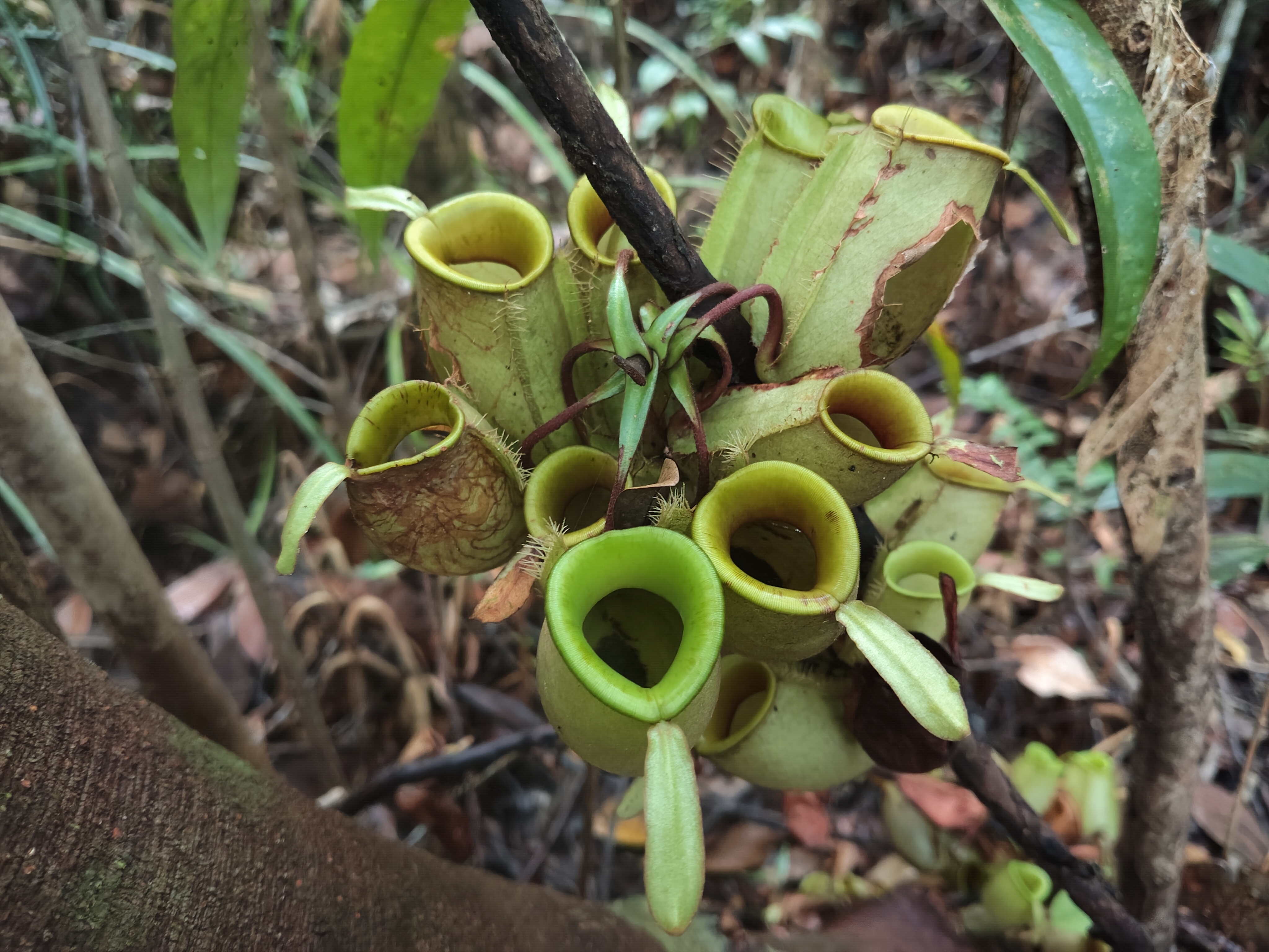
Picture 4. A pitcher plant, one of the plant species found in Pangabuyan Forest.
Source: 4F Documentation
These three forest areas hold great significance for the people of Karta Mulia Village, particularly Pangabuyan and Pencaburan Forests, as both lie close to the old ancestral village where their forebears once farmed the land and made their living from the forest. Although the Gambu Dalam area is now a wildlife sanctuary, it remains an important place in the history of their ancestors’ migration. In general, the area is regarded as communal territory, within which lie traces of old settlements predating the forest and land fires, such as cempedak fruit trees and a taratak (a place of prayer for adherents of Kaharingan). These strong bonds, values and historical evidence have led some Karta Mulia residents descended from Datuk Jambu — the village’s first ancestor — to feel no hesitation in clearing independent oil palm smallholdings within the Gambu Dalam area, around Pangabuyan and Pencaburan Forests.
Around these two forests (before the 1887 fire disaster), the Dayak Ngaju Gambu Dalam community — the ancestors of today’s Karta Mulia people — managed forest resources and met their needs by adapting to their ecological spaces (forest, rivers, lakes, water, soil, air). One example of this system of managing ecological space was pelakauan, a subsistence production-consumption unit in which a nuclear family could cultivate more than 2 hectares of rotational dryland rice fields (natai) for around one growing season per year*. In simple terms, pelakauan refers to agroforestry — slash-and-burn cultivation for dryland rice, seasonal and perennial crops, alongside the surrounding forest. This pelakauan system depended heavily on the presence of primary forest, from which both non-timber and timber forest products were harvested.
Over time, the landscape that supported the pelakauan system was destroyed. The shifting cultivators who had once lived in dukuh (remote hamlets) decided to relocate permanently to the larger settlement along the banks of the Pomponing River — today’s main settlement of Karta Mulia Village. The hamlets around the Sagu, Lubuk Hitam and Sendaas Rivers were cleared by PT Sungai Rangit and converted into nucleus plantation estates: Sukamara Estate, covering 2,678 hectares, and Sungai Sagu Estate, covering 3,397 hectares. Meanwhile, part of the former large settlement at Kalokalibar Gambu Dalam, which had been struck by major land fires in 1987 and 1995, was also converted into Telaga Bintang Estate, covering 1,868 hectares, and became part of the Lamandau Wildlife Sanctuary concession.
Picture 6. Independent (smallholder) oil palm land belonging to residents, located within the Lamandau Wildlife Sanctuary area.
Source: 4F Documentation
Being hemmed in between these concessions has prevented the community from enjoying their traditional rights within the forest (forest use through pelakauan), and from gathering timber and non-timber forest products (jelutong latex, rubber latex, gembor bark, honey, rattan). Today, the people of Karta Mulia must coexist with at least two giants: PT Sungai Rangit and the Lamandau Wildlife Sanctuary. With regard to PT Sungai Rangit in particular, the community has lost the opportunity to cultivate mineral soil land (natai) that once served as their fertile farming territory. Consequently, amid an increasingly limited space for small-scale cultivation, some residents have now begun to risk planting open, previously burned land within the wildlife sanctuary area as independent oil palm smallholdings.
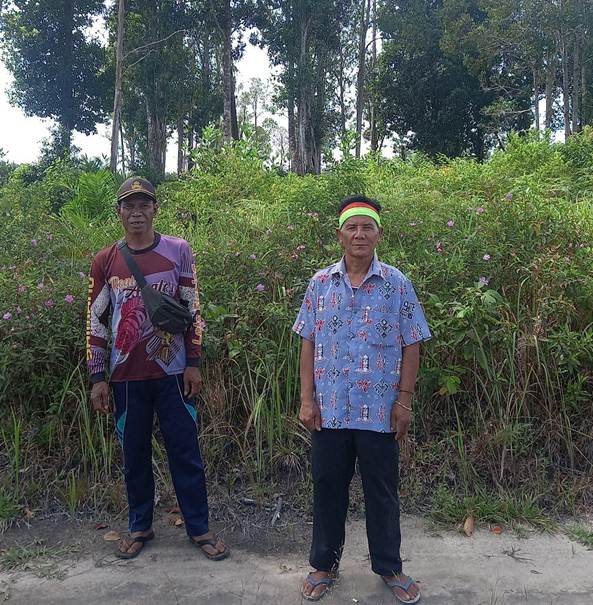
Picture 6. Domung (customary chief) of the Dayak Ngaju Gambu Dalam, Mr Mundur (right), with his deputy, Mr Hayun (left).
Source: 4F Documentation.
Meanwhile, alongside growing awareness of forest protection and the legalisation of Karta Mulia Village’s customary institution, the domung (customary chief), his deputy, and the village’s customary administrators want to see a forest area in Karta Mulia recognised as customary forest (hutan adat). Of the three forests they have proposed for this status, two (Pangabuyan and Pencaburan Forests) fall within the wildlife sanctuary area, and one (Pomponing Customary Forest) falls within a production forest area. The status of these three forest areas will make it very difficult for the Dayak Ngaju Gambu Dalam customary community to have them recognised as customary forest. Yet, amid this uncertain situation, the deputy domung remains optimistic and hopes that all three forests can become their customary forest. “We sincerely hope — not just us, but the whole community — that Pangabuyan, Pencaburan and Pomponing can become our customary forest. We long deeply to have a customary forest of our own. This is the land where our ancestors once settled and farmed, so it is the land we have inherited from them. We want it to remain ours for generations to come. We hope the gentlemen and ladies in government, in the relevant agencies, and also 4F, can help us achieve this customary forest.” So said Mr Hayun, firmly.